Rambara, the midway halting point for the arduous 14km trek to Kedarnath from Gaurikund at a height of nearly 4,600 metres, was washed away during the 2013 cloud burst and subsequent floods that claimed 6,000 lives.
The Uttarakhand government will reopen the traditional pilgrim trail to the Kedarnath shrine from Gaurikund in Rudraprayag district via Rambara, officials said on Tuesday, after the state wildlife board provided its approval.
“A preliminary survey of the area for construction on the route is complete and the Public Works Department has been directed to speed up the process of land transfer so that the old track from Gaurikund to Kedarnath via Rambara can be revived for the pilgrims,” state tourism minister Satpal Maharaj said.
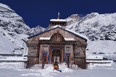
Rambara, the midway halting point for the arduous 14km trek to Kedarnath from Gaurikund at a height of nearly 4,600 metres, was washed away during the 2013 cloud burst and subsequent floods that claimed 6,000 lives. The authorities opened an alternate trail to reach Kedarnath, one of the four shrines of the Char Dham yatra.
“We plan to start the construction on traditional Kedarnath route from this yatra season,” Maharaj said.
“The project has been approved by the state wildlife board, and after the land transfer process, the work will be initiated,” said Inder Singh Negi, divisional forest officer at Kedarnath Wildlife Sanctuary. The shrine is located inside the sanctuary.
“We have completed the survey and identification of the construction work that needs to be done,” said Praveen Kumar, executive engineer of PWD, Rudraprayag. “We have sent the proposal to the forest department nodal officer in Dehradun, after which the work will begin.”
The PWD has received ₹10 crore for the work, he added. The traditional route will be used as an alternative to the Kedarnath trail that was built after the 2013 tragedy. Plans are also afoot move the mule and horses operation on this route, officials said.
In March 2014, a new route was opened on the left bank of the Mandakini river to reach Kedarnath but the sharp turns and steep climbs right up to Lincholi makes it difficult for pilgrims compared with the easier old route.
“Once completed, the old route will act as an alternate to the current route, and will link Garud Chatti from both ends,” said Mahesh Sharma, a resident of Sonprayag, which lies before Gourikund. Garud Chatti is the last resting point before approaching the Kedarnath valley.
Hindustan Times


